


ARTHUR - T 1 Voting District, Chippewa County, Wisconsin
About
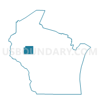
Outline

Summary
| Unique Area Identifier | 692685 |
| Name | ARTHUR - T 1 Voting District |
| County | Chippewa County |
| State | Wisconsin |
| Area (square miles) | 43.06 |
| Land Area (square miles) | 42.88 |
| Water Area (square miles) | 0.18 |
| % of Land Area | 99.58 |
| % of Water Area | 0.42 |
| Latitude of the Internal Point | 45.06017630 |
| Longtitude of the Internal Point | -91.15553810 |
Maps


Graphs
Select a template below for downloading or customizing gragh for ARTHUR - T 1 Voting District, Chippewa County, Wisconsin


Neighbors
Neighoring Voting District (by Name) Neighboring Voting District on the Map
- ANSON - T 1 Voting District, Chippewa County, WI
- CLEVELAND - T 1 Voting District, Chippewa County, WI
- COLBURN - T 1 Voting District, Chippewa County, WI
- DELMAR - T 1 Voting District, Chippewa County, WI
- EAGLE POINT - T 4 Voting District, Chippewa County, WI
- ESTELLA - T 1 Voting District, Chippewa County, WI
- GOETZ - T 1 Voting District, Chippewa County, WI
- GOETZ - T 2 Voting District, Chippewa County, WI
Top 10 Neighboring County Subdivision (by Population) Neighboring County Subdivision on the Map
- Eagle Point town, Chippewa County, WI (3,053)
- Anson town, Chippewa County, WI (2,076)
- Delmar town, Chippewa County, WI (936)
- Cleveland town, Chippewa County, WI (864)
- Colburn town, Chippewa County, WI (856)
- Goetz town, Chippewa County, WI (762)
- Arthur town, Chippewa County, WI (759)
- Estella town, Chippewa County, WI (433)